Digital Twin Technology for Urban Planning 2026: The Blueprint for Sentient Cities
The concept of a “smart city” has long been a fixture of science fiction, but as we navigate 2026, that vision has crystallized into a data-driven reality through digital twin technology. A digital twin is no longer just a static 3D model of a building or a bridge; it is a living, breathing virtual mirror of a physical urban environment, synchronized in real-time via a massive network of IoT sensors, satellite imagery, and high-speed connectivity. For urban planners, this technology represents the most significant leap forward since the invention of the blueprint. It allows for the simulation of complex urban scenarios—from the path of a flash flood to the traffic impact of a new stadium—before a single ounce of concrete is poured.
In 2026, digital twins have become the primary operating system for modern metropolises. As global populations continue to migrate toward urban centers, the pressure on infrastructure, energy grids, and housing has reached a critical tipping point. Digital twin technology provides the analytical foresight required to manage this growth sustainably. By bridging the gap between the physical and virtual worlds, cities are evolving from reactive entities into “sentient” environments that can predict failures, optimize resources, and improve the quality of life for millions. This article explores the architecture of this technology, its real-world applications in 2026, and the profound impact it is having on the way we inhabit the modern world.
The Architecture of a 2026 Digital Twin: How It Works
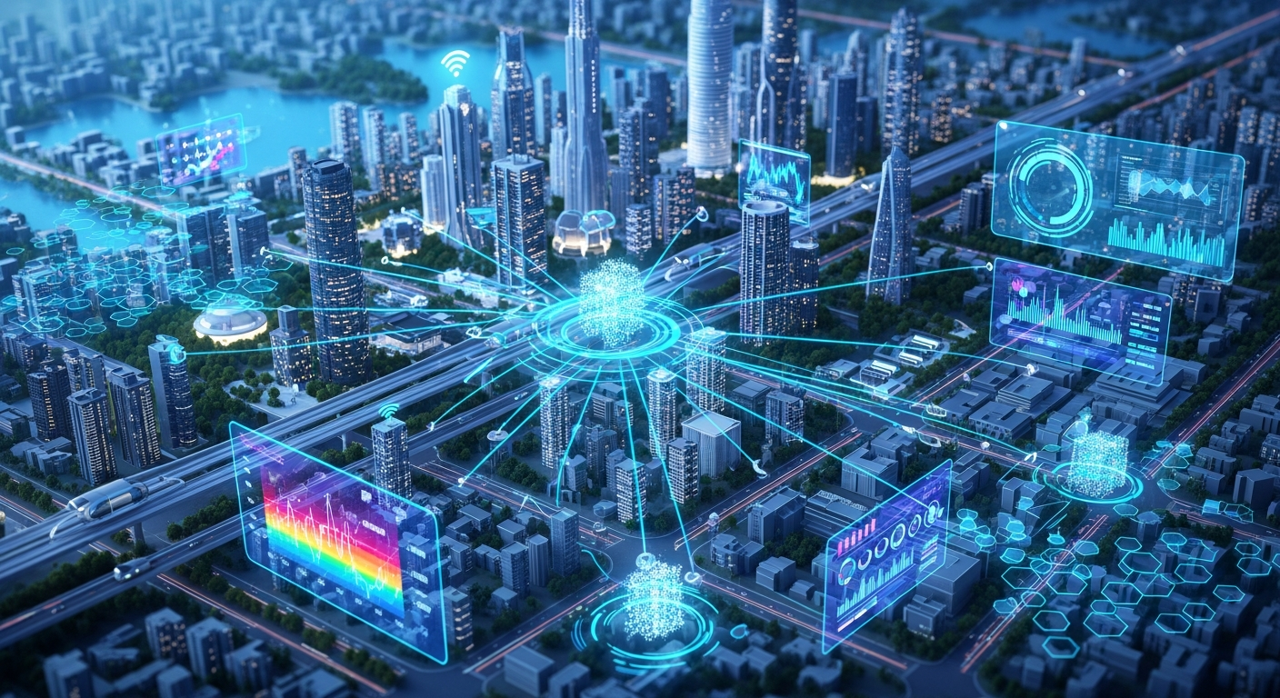
To understand the power of digital twins in 2026, one must look at the layers of technology that comprise them. At its core, a digital twin is built on a foundation of data acquisition. This involves a multi-modal approach: LiDAR-equipped drones perform weekly sweeps to capture millimeter-accurate spatial changes, while millions of IoT (Internet of Things) sensors embedded in roads, pipes, and utility poles provide a constant pulse of operational data.
Once the data is collected, it is processed through an integration layer. By 2026, the arrival of 6G-ready infrastructure and mature 5G networks has reduced latency to near-zero, allowing the virtual model to reflect physical reality in milliseconds. This data is then fed into AI-driven simulation engines. These are not simple “if-then” algorithms; they are sophisticated physics-based engines capable of simulating fluid dynamics, heat transfer, and human behavioral patterns.
The final layer is visualization and interaction. While planners previously viewed these twins on flat monitors, the standard in 2026 involves immersive Spatial Computing. Using AR (Augmented Reality) headsets, city officials can “walk” through a virtual version of a proposed park, seeing how shadows fall at different times of the year or how wind tunnels are created by surrounding skyscrapers. This holistic stack—from sensor to simulation—is what makes the digital twin an indispensable tool for 2026 urbanism.
The 2026 Paradigm Shift: From Descriptive to Prescriptive Planning
In previous years, digital tools were primarily descriptive—they told us what was happening. In 2026, the technology has shifted to being prescriptive and predictive. We are no longer just looking at a map of current traffic congestion; we are using generative AI integrated with digital twins to ask the system for solutions.
Planners in 2026 utilize “Generative Urban Design.” A user can input specific parameters—such as a requirement for 500 units of affordable housing, a 20% increase in green space, and zero impact on existing drainage systems—and the digital twin will run millions of permutations to find the optimal layout. This moves the planning process from months of manual drafting to hours of AI-assisted iteration.
Furthermore, these twins are now capable of “Stress Test Simulations.” As climate volatility increases, cities use their virtual counterparts to simulate extreme weather events. By 2026, digital twins can accurately predict which specific basements will flood during a once-in-a-century storm, allowing the city to proactively reinforce infrastructure or install temporary barriers exactly where they are needed. This shift from “guessing” to “knowing” is saving billions in disaster recovery costs.
Transforming Infrastructure and Sustainable Resource Management
Sustainability is no longer an elective feature of urban planning; it is a survival mandate. Digital twin technology in 2026 serves as the central nervous system for a city’s circular economy. One of the most impactful applications is in “Virtual Power Plants” (VPPs). By twinning the city’s energy grid, planners can manage the decentralized input from thousands of solar-paneled roofs and EV batteries. The twin predicts energy surges and redistributes power in real-time, drastically reducing the reliance on carbon-heavy peaking power plants.
Water management has also been revolutionized. In 2026, digital twins of subterranean pipe networks use acoustic sensors to detect microscopic leaks before they become catastrophic bursts. By simulating water flow and pressure, cities can optimize pump speeds, reducing energy consumption and preserving precious freshwater resources.
Waste management has similarly gone high-tech. Digital twins track the fill-levels of smart bins and the real-time locations of collection fleets. AI then calculates the most fuel-efficient routes based on current traffic and bin capacity. This “Just-in-Time” logistics model reduces the carbon footprint of city services while ensuring that urban environments remain clean and hygienic.
Revolutionizing Urban Mobility and Autonomous Corridors
The transportation landscape of 2026 is vastly different from that of the early 2020s, characterized by the rise of micro-mobility, autonomous shuttles, and the early stages of urban air mobility (UAM). Digital twins are the essential “Air Traffic Control” for these systems.
In 2026, autonomous vehicle (AV) corridors are managed via the digital twin. The virtual model communicates with the AVs’ onboard computers, providing them with “beyond-line-of-sight” data about pedestrians or road obstructions around the corner. This creates a safety buffer that makes Level 4 autonomy viable in dense urban environments.
Moreover, the integration of eVTOL (electric Vertical Take-Off and Landing) aircraft—the so-called “flying taxis”—relies entirely on digital twin technology. These vehicles operate in complex low-altitude corridors. The digital twin simulates wind gusts between buildings and monitors the “noise footprint” of flight paths to minimize the impact on residents. By managing the city’s “vertical real estate,” digital twins allow for a three-dimensional transportation network that was once a logistical impossibility.
Democratizing the City: Citizen Engagement and Gamification
Perhaps the most surprising evolution of digital twin technology in 2026 is its role in social equity and civic engagement. Historically, urban planning was a top-down process that often left residents feeling alienated. Today, the digital twin has “democratized” design.
Cities now release “Citizen Portals” where residents can access a simplified version of the digital twin on their smartphones. If a new library is proposed for a neighborhood, residents can use AR to see exactly how it will look from their front porch. They can participate in “Gamified Planning,” where they are given a virtual budget to spend on community improvements within the twin—choosing between more street lighting, a bike lane, or a community garden.
This feedback is not just anecdotal; it is data-mined. The digital twin aggregates public sentiment and usage patterns, ensuring that the final physical build reflects the actual needs of the population. This has led to a significant increase in public trust and a decrease in “NIMBYism” (Not In My Backyard), as residents can see the data-backed benefits of new developments before they begin.
Overcoming Hurdles: Privacy, Security, and Data Interoperability
Despite the immense benefits, the proliferation of digital twin technology in 2026 brings significant challenges, primarily regarding data privacy and cybersecurity. A city that is fully mapped and monitored is a city that is potentially vulnerable. If a malicious actor gains access to a city’s digital twin, they could theoretically manipulate traffic lights, interfere with water pressure, or disrupt energy distribution.
To combat this, 2026 has seen the rise of “Sovereign Urban Data Vaults.” These are highly encrypted, decentralized storage systems where city data is partitioned. Instead of a single “God-mode” database, the digital twin operates on a “zero-trust” architecture, requiring multi-factor authentication for every data request.
There is also the issue of the “Digital Divide.” As elite global cities become more efficient through digital twins, there is a risk that smaller or less wealthy municipalities will be left behind. In 2026, international organizations are working on “Open-Source Twin Standards” to ensure that the software blueprints for these virtual cities are interoperable and accessible, preventing a future where only the wealthiest citizens live in “optimized” environments.
FAQ: Digital Twin Technology in 2026
1. What is the main difference between a digital twin and a traditional 3D city map?
A traditional 3D map is static and reflects a snapshot in time. A 2026 digital twin is dynamic and “alive,” meaning it is updated in real-time by IoT sensors and AI. It doesn’t just show you where a building is; it shows you how much energy that building is consuming and how it affects the wind patterns on the street below right now.
2. How does digital twin technology help in the fight against climate change?
Digital twins allow cities to simulate “what-if” scenarios for carbon reduction. They optimize energy grids for renewable sources, reduce traffic congestion (and thus emissions), and help design more efficient cooling systems to combat the “Urban Heat Island” effect. In 2026, they are the primary tool for hitting Net Zero targets.
3. Does this technology mean every move I make is being tracked by the city?
While the twin uses massive amounts of data, in 2026, strict “Anonymization by Design” protocols are the standard. The system tracks “flows” and “patterns” (e.g., 50 people moving through a plaza) rather than individual identities. Privacy-preserving computation ensures that the digital twin can optimize the city without knowing your personal name or business.
4. Can small towns use digital twins, or is this only for “Megacities”?
While early adoption was in megacities like Singapore and London, 2026 has seen the rise of “Modular Twins.” These are scaled-down, affordable versions of the technology that allow small towns to focus on specific problems, such as managing a local water table or optimizing a single main-street traffic light system.
5. How accurate are the predictions made by a digital twin?
By 2026, thanks to the integration of quantum-inspired computing and massive historical datasets, short-term predictive accuracy (e.g., traffic patterns or energy spikes over the next 24 hours) often exceeds 95%. Long-term simulations (e.g., urban growth over 10 years) are used as “probabilistic models” rather than certainties, helping planners prepare for multiple possible futures.
Conclusion: The Sentient City and Beyond
As we look toward the horizon of the late 2020s, digital twin technology is no longer viewed as a luxury “tech feature” but as a fundamental human right for urban dwellers. The ability to live in a city that is safe, efficient, and responsive to its environment is the new standard for 2026. These virtual mirrors have taught us that the city is not just a collection of buildings, but a complex, interconnected ecosystem where every action has a ripple effect.
Looking ahead, the next frontier will likely involve the “Internet of Twins,” where the digital twins of different cities begin to communicate with one another, sharing data on global logistics, weather patterns, and migration trends. We are moving toward a world where the physical and digital are so inextricably linked that the term “planning” will simply mean “simulating the best possible future.” In 2026, the blueprint has been replaced by the heartbeat of the digital twin, and the results are cities that are finally as smart as the people who live in them.